The LUC mapping and classification system is 'independent' of scale and can be used nationally down to local level. For the NZLRI, LUC was originally mapped at a scale of 1:63,360. Edition 2 was mapped in Northland, Gisborne, Wellington, and Marlborough at a scale of 1:50,000.
Mapping scale is usually based on the smallest area of interest
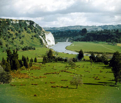
Aerial photo base and photo mosaic can be used, for example in farm mapping. This scale can change if more detail is required, for example pastoral which can be mapped using photos at a scale of 1:10,000, and for horticulture at 1:500.
For farm LUC mapping this is often the smallest area of land that can be managed or treated differently (e.g. two different soils within a paddock, two erosion severities occurring on the same slope). These ‘smallest areas’ translate to a recommended farm-mapping scale of between 1:5,000 and 1:15,000 depending on management intensity seen in Table 1 of the Land Use Capability Survey Handbook (3rd Edition).
Table 1: Suggested mapping scales for LRI survey and LUC classification (after Manderson & Palmer 2006).
| Smallest area of interest |
Corresponding scale |
Common applications |
| 10m2 |
1:500 |
Horticulture, viticulture, localised riparian studies |
| 0.1ha |
1:5,000 |
Horticulture, viticulture, arable, intensive pastoral |
| 0.4ha |
1:10,000 |
Arable, pastoral |
| 1ha |
1:15,000 |
pastoral, catchment studies |
| 5ha |
1:35,000 |
Extensive pastoral, catchment studies, forest surveys |
| 10ha |
1:50,000 |
District and regional studies |
Regional government LUC (catchment and property-scale) usually used an aerial photo base. Individual small farms used a single aerial image, but for larger farms or catchments an aerial photo mosaic was usually used. Modern farm-scale mapping should be based on orthorectified photo mosaic data but still generally uses ‘traditional’ mapping techniques.
Detailed scales are less suitable for regional mapping projects that often involve extensive areas. In such cases a 1:50,000 scale is often more appropriate. This is equivalent to 10 hectares (ha) ‘smallest area’, which is sufficient to capture major soils and landform types.
Scale is also important when using NZLRI and LUC map information in Geographic Information Systems (GIS). Such systems can readily rescale the information beyond its original scale of collection. Significantly enlarging the scale can produce unreliable and misleading results or result in information that is at best nonsense (Hewitt & Lilburne 2003; Manderson & Palmer 2006).
As a general rule, NZLRI and LUC information should not be significantly enlarged beyond the scale at which it was originally collected. Worksheets be used either at the existing scale (1:63,360) or at less detailed scales (e.g., 1:100,000 or 1:250,00). As with all maps, worksheets should not be enlarged as they cannot be relied upon to show boundaries with an accuracy appropriate to that more detailed scale.
Table 2: Guidelines to the selection of appropriate scales for extensive LRI / LUC surveys (Modified from McRae & Burnham 1981 and Jessen 1987). Source: Land Use Capability Survey Handbook (3rd Edition).
| Scale level1 |
National |
Regional |
District and catchment |
Local |
| Scale2 |
1:250,000 to 1:100,000 |
1:100,000 to 1:50,000 |
1:50,000 to 1:15,000 |
1:<15,000 |
| Scale size3 |
Small |
→ |
Large |
| Map details4 |
General |
→ |
Detailed |
| Smallest area4 |
40-250ha |
10-40ha |
1-10ha |
≤1ha |
| LUC level |
Dominant capability class or subclass |
LUC units (regions) |
LUC unit (regional) |
LUC unit (regional and farm5) |
| Common application examples |
Strategic overview. broad planning, prioritising or targeting projects for detailed investigations |
Land use planning, targeting of regional priorities and projects, reference for more detailed survey |
Catchment projects, small district / community projects, farm planning for large projects |
Farm planning (detailed) nutrient budgeting, farm development projects, precision agriculture |
1 Scale level are subjective. meaning is often dependent on context (e.g. a 'detailed' scale in a farming context is different from a 'detailed' scale in a regional content).
2 Recommendations are based on common NZ scales used in soil, geology, and LRI / LUC surveys.
3 Large- and small-scale terminology is confusing. A 'large scale (e.g., 1:5,0000) is actually more detailed than a 'small' scale (e.g., 1:500,0000). Scales are essentially fractions. and fractions with large denominators are smaller numbers (e.g., 1:5,000 is the same as 1/5000 or 0.0002, which is a larger number that 1:500,000 = 0.000002).
4 The smallest area of interest represents the minimum legible are (MLA) that can be displayed on a paper map at a given scale. any smaller and labelling becomes illegible, and line boundaries become disproportionate. Modern digital printing can accommodate a minimum legible area as small as 0.4cm2 (after Forbes et al 1982).
5 Occasionally regional LUC units may require adaptation at farm scale (see Section 4.4 Land Use Capability Survey Handbook [3rd Edition])
While it is not uncommon in modern GIS and on-line portals to view NZLRI and LUC at more detailed scales than its original mapping scale, this caution should always be remembered when interpreting LUC mapping.
Scale determines the level of variation that can be captured within a mapping unit. If two or more LUC units are present, the dominant unit size is assigned.