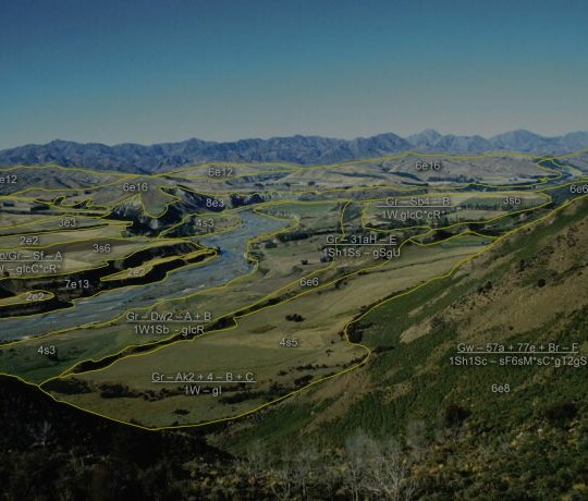
LUC at regional level
At a Regional scale LUC can be useful in identifying the land use capacity in the region. This can aid in identifying the highly productive land that is a requirement for the National Policy statement.
A LUC map may also be useful to the Consents Planner when accessing the land, especially regarding the National Policy Statement – Highly Productive Land.
Best practice of use

Policy Context
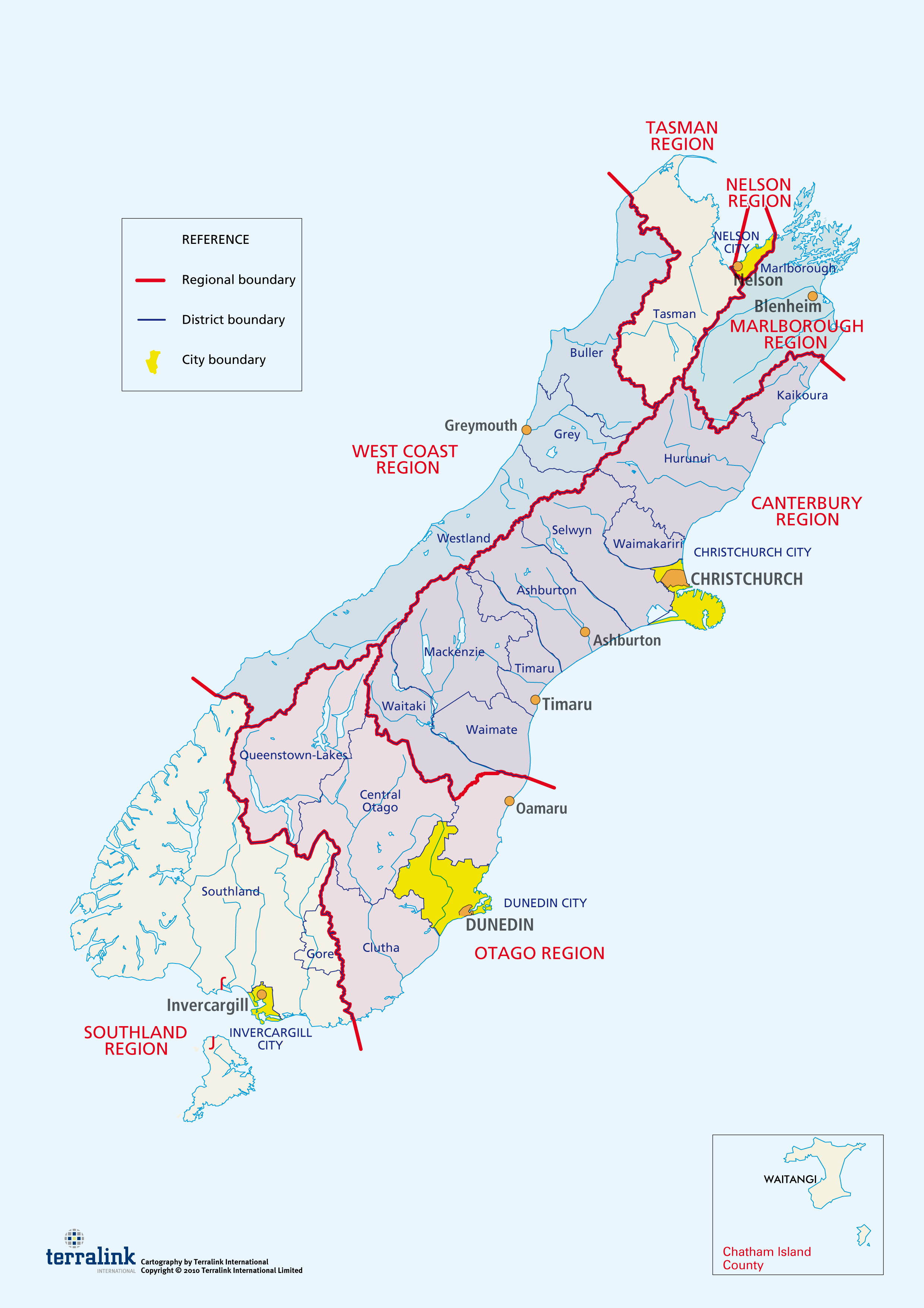
Boundaries for all regional, district and city councils in New Zealand

Examples of Land Use Capability maps


Land Use Capability
Our Environment
An interactive, free, online service providing access to some of Manaaki Whenua´s considerable holdings of environmental data including the the Land Use Capability (LUC) classification.
A brief description of the LUC data can be viewed, the map key, and information relating to each of the LUC's classes is displayed and reporting tools (single location, LINZ property boundaries, Māori Land Blocks, Territorial Authorities or the Regional Councils) are available.
A brief description of the LUC data can be viewed, the map key, and information relating to each of the LUC's classes is displayed and reporting tools (single location, LINZ property boundaries, Māori Land Blocks, Territorial Authorities or the Regional Councils) are available.