LUC applications
The Land Use Capability (LUC) system is important to help achieve sustainable land development and management
LUC applications
LUC can be used for strategic overview, broad planning, prioritising, or targeting projects for detailed investigations.
Large and extensive surveys are undertaken at national levels. They typically cover large areas, use less detailed scales and have a general rather than specific resource management purpose and can be used for many different applications.
Large and extensive surveys are undertaken at district and regional levels. They typically cover large areas, use less detailed scales and have a general rather than specific resource management purpose and can be used for many different applications.
Regional Level
LLUC can be used for land use planning, targeting of regional priorities and projects, and as a reference for more detailed surveys.
At a Regional scale LUC can be useful in identifying the land use capacity in the region. This can aid in identifying the highly productive land that is a requirement for the National Policy statement.
A LUC map may also be useful to the Consents Planner when accessing the land, especially regarding the National Policy Statement – Highly Productive Land.
Regional Land Use Capability (LUC) Surveys have been completed for some parts of New Zealand.
- Gisborne and the East Cape have a well-founded history of using LUC to help plan and implement sustainable land use.
- The East Coast Forestry Project provides a district/regional application example of the LUC system. It was established to address widespread and severe erosion and aims to achieve sustainable land management across 60,000 hectares (ha) of severely eroding land by 2020.
- A survey for the Horizons Regional Council in 2009 produced a consolidated LUC Geographic Information System database for the region and to provide accompanying documentation including a summary report and key maps.
District and Catchment Level
LUC can be used for catchment projects, small district/community projects, and farm planning for large properties.
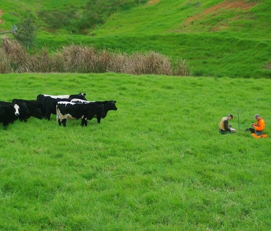
Land Resource Inventory (LRI) and Land Use Capability (LUC) surveys at local level are undertaken predominantly for ‘farm planning’, where NZLRI and LUC form the basis of developing a programme for improved resource use and management.
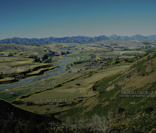
LUC at local level usually requires more detailed mapping than is available from the national dataset. LUC can be used for farm planning in detail, nutrient budgeting, farm development projects, precision agriculture.
LUC classifications can be helpful to Māori land block owners and trusts. LUC can be used to identify the best use of the land, and this could lead to a change in its management of the land. The map source can show the Territorial Authorities and Regional Counci boundaries. Therefore, the council plans will be easier to identify and what rules will need to be complied with for different activities on the Māori land blocks.
LUC can be used to determine the establishment of productive exotic forest based on assessment of the physical factors of the site. Classes 1 to 7 are recommended for forestry.
The mapping scale for forestry is 5 hectares for the smallest area with a corresponding scale of 1:35,000. Slope, soil erosion, and slope stability can influence forestry operations, .
For forestry operations slopes between 18° and 20° are the accepted maximum limit for rubber-tyred skidders on favourable slopes subject to weather conditions. The accepted maximum limit for tracked machines vary between 22° and 26°. Some specialised self-levelling tracked machines can work on favourable slopes up to 30°.
The National Environmental Standards for Plantation Forestry (NES-PF) may apply and will need to be consulted.
Land is classified into eight land-use capability (LUC) classes based on its potential for sustained production in the long term. The classes are based on soil properties, soil sensitivity to erosion, vegetation cover, and terrain (Lynn et al., 2009). The first four classes (LUC 1–4) are most suitable for cropping and most productive for pasture and forestry. Land classified as LUC 8 is not used for agriculture and is often conservation land.
LUC class 1 land is the most versatile (it can grow the largest range of crops) and has few limitations on how it can be used. LUC class 2 is also versatile and has slight limitations. LUC class 3 land has moderate limitations. LUC classes 1–2 are known as highly versatile land and LUC classes 1–3 as highly productive land.
Highly versatile and highly productive land are scarce, finite resources – 5 percent of New Zealand’s total land area is highly versatile and 15 percent is highly productive.
The Ministry for the Environment's (MfE) Our land 2018 report refers to urban expansion into land they have classified as versatile land. The report refers to the terminology of the Land Use Capacity (LUC) classification of high-class land being LUC Classes 1-3 and the changes from this high-class land to urban areas.
Our land 2018 report uses LUC to show that between 1990 and 2008, 29 percent of new urban areas were on high-class land (based on LUC 1–2 only). They also refer to regional level that LUC shows between 1990 and 2008 the greatest areas of conversion from high-class land to urban use were in Canterbury (4,800 hectares) and Auckland (2,600 hectares).
Fragmentation of land on urban fringes is also mentioned in Our land 2018. This refers to agricultural land on the fringes of urban areas being subdivided into lifestyle blocks. The outward growth of urban centres in New Zealand between 1990 and 2008 consumed 0.5 percent of high-class land (LUC classes 1–2). It also showed that lifestyle blocks had already occupied 10 percent of high-class land.
MfE uses LUC to report on various aspects including urban expansion into highly productive land and fragmentation of this land.
With the introduction of the National Policy Statement for Highly Productive Land (NPS-HPL) LUC is a useful tool. Regional and Local Councils can use LUC to help meet the requirements of identifying and mapping HPL and incorporating these into their updated Regional and District Plans.


