The national LUC legend
What is the national LUC legend?

Should I use the national rather than a regional LUC legend?
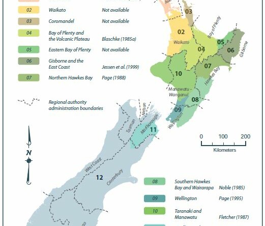
How has the national legend been compiled?
How is the national legend documented?

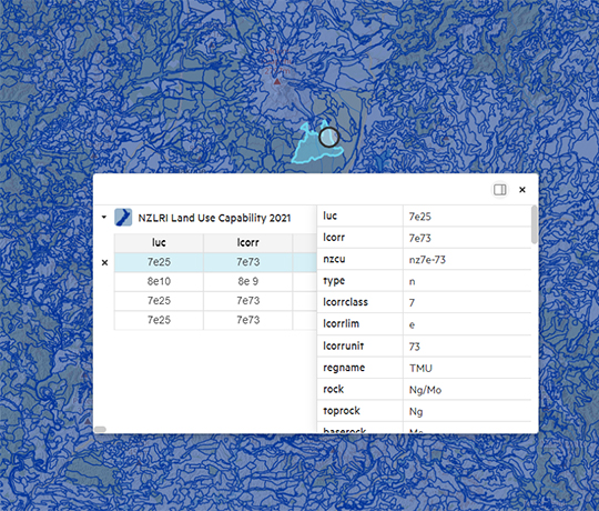
How can I access the national LUC legend?